Greater Toronto & Hamilton Area, Simcoe County, Barrie, Orillia & Waterloo Region Land Supply Analysis
Malone Given Parsons Ltd. has prepared and continuously maintains detailed land use mapping as part of our Planned Urban Structure map for the Greater Golden Horseshoe since 2001. Over the past 22 years, we have continually updated and accumulated data within our GIS database, providing our firm with knowledge-based context in undertaking land use planning and land economics for large projects throughout the Greater Golden Horseshoe, and serving as a powerful analytical tool in our day-to-day practice.
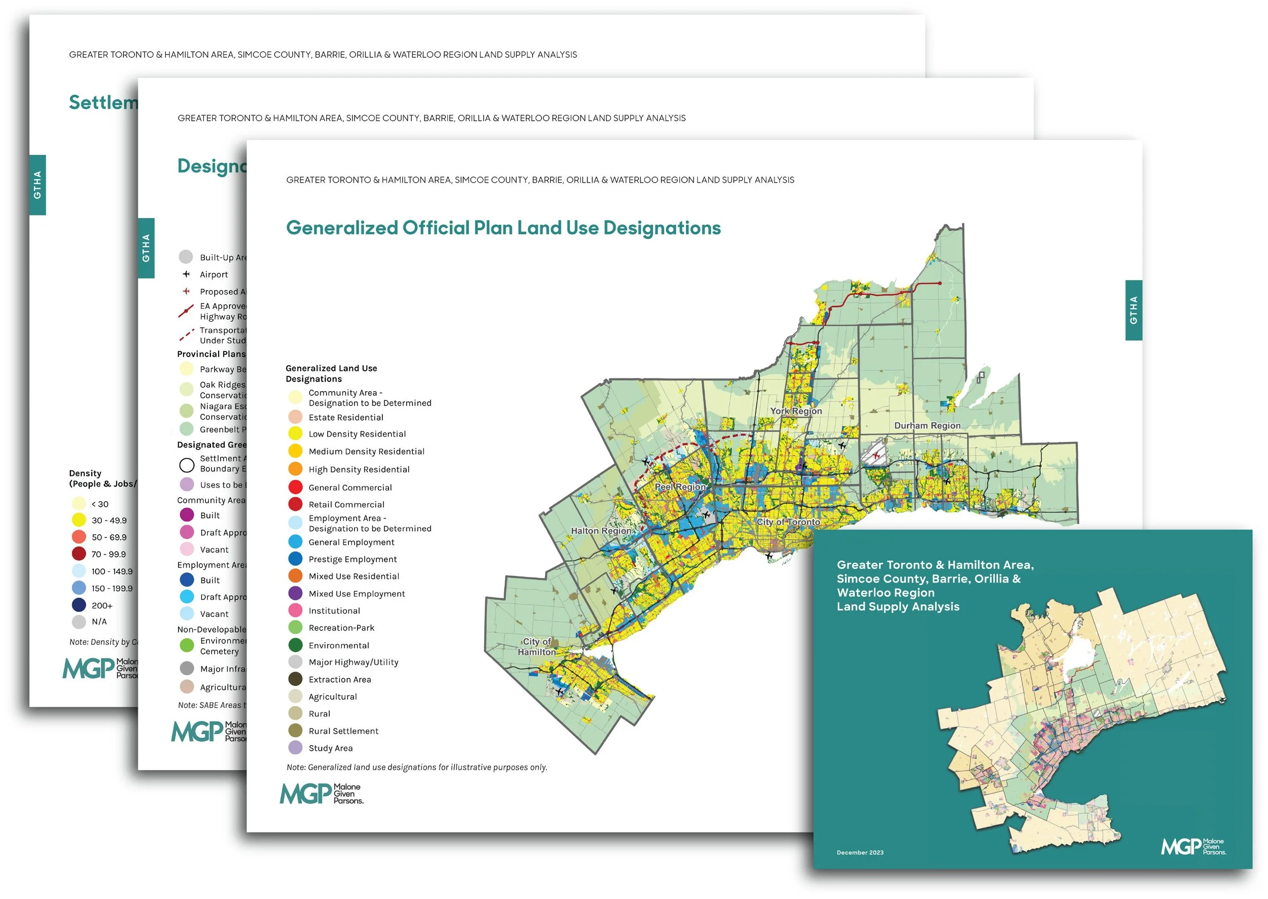
The analysis in this report leverages our mapping and planning insight to provide an accurate account of all DGA land supply in the Greater Toronto and Hamilton Area, Simcoe County, Barrie, Orillia, and Waterloo Region. This is presented through mapping and land area statistics for each of the upper-tier, lower-tier, and single-tier municipalities in the above-noted areas, with the primary purpose of determining whether the 2051 population and employment forecasts of the 2020 Growth Plan will be achieved. This analysis also provides an overview of Official Plan land use designations and corresponding density to characterize the planning context and as a basis for discussion of key challenges to development in each region.
Download the Report (Warning: 90MB File)